Aerial Mapping GCPs: Achieving High-Accuracy Drone Surveys
Aerial mapping has completely changed how industries collect and use data. Whether it’s for construction, agriculture, mining, or environmental research, drones can now capture detailed images that are processed into maps, 3D models, and measurements in record time.
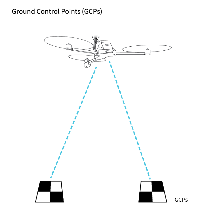
But even the most advanced drone can only go so far without the right support system. That’s where aerial mapping GCPs—Ground Control Points—come in. These markers act as anchors for your aerial images, ensuring that the final maps are not only detailed but also incredibly accurate.
What Exactly Are Ground Control Points?
Ground Control Points (GCPs) are highly visible markers placed across a survey area before a drone flight. Each point’s precise coordinates are measured using high-accuracy GPS tools, such as RTK (Real-Time Kinematic) or PPK (Post-Processed Kinematic) systems. When the drone’s images are processed later, these points help align everything perfectly to real-world positions.
What Makes a Good GCP?
- Visibility – Strong contrast patterns (often black and white) help cameras pick them up easily.
- Durability – Built to handle outdoor conditions like wind, rain, and sun.
- Precision – Location measured with centimeter-level accuracy using survey-grade equipment.
Think of GCPs as the invisible framework that holds an aerial map together, making sure every image lines up exactly where it should.
Why Are GCPs So Important in Aerial Mapping?
1. Accuracy That Goes Beyond Drone GPS
Standard drone GPS can be off by a meter or more, which might work for rough visualizations but won’t cut it for engineering or construction projects. GCPs reduce that error to just a few centimeters, which can make all the difference when measurements need to be precise.
2. Cleaner Orthomosaic Maps
Orthomosaics—stitched images that form a single, seamless map—depend on proper alignment. Without GCPs, small misalignments can add up, causing distortions. GCPs act as control points to lock everything in place and ensure a smooth, accurate final product.
3. Meeting Professional Standards
Many projects—especially those in engineering, surveying, and government work—must meet specific accuracy requirements. GCPs help ensure deliverables meet standards such as those set by ASPRS or USGS.
How to Use GCPs the Right Way
Step 1: Plan Before You Fly
Before placing GCPs, figure out how many you’ll need. A small area may only require five or six points, but a large or uneven site might need 15–20 or more to capture variations in elevation and terrain.
Step 2: Place Them Where They Matter
Strategically position GCPs across your survey area, including near corners, at changes in terrain, and within central sections. Good placement means better image alignment and more reliable results.
Step 3: Record Each Point Precisely
Using RTK or PPK GPS equipment, record the exact coordinates of every GCP. Even a small error at this stage can affect the entire project’s accuracy.
Step 4: Process and Align in Software
After the drone flight, import both your imagery and GCP coordinates into photogrammetry software like Pix4D, DroneDeploy, or Agisoft Metashape. The software uses these points to lock images into their correct positions.
Tips for Getting the Most Out of GCPs
- Use Weatherproof Targets – Keeps GCPs stable and visible, even in challenging conditions.
- Go High-Contrast – Black-and-white checkerboard patterns are ideal for visibility.
- Avoid Obstructions – Shadows, vegetation, or debris can interfere with image detection.
- Double-Check Measurements – Accurate data capture ensures accurate results.
A Real-World Example
A construction company needed a precise topographic survey of a 150-acre site to calculate cut-and-fill volumes for earthmoving. By deploying 18 GCPs across various elevations, the team reduced positional errors to under three centimeters. This accuracy translated to more reliable calculations, preventing costly overestimates or underestimates and keeping the project on schedule.
Frequently Asked Questions About GCPs
How Many GCPs Should I Use?
It depends on the size and complexity of your site. For small areas, five points may be enough. For larger or more complex terrains, plan for additional markers to ensure consistency.
Do I Always Need GCPs?
Not necessarily. Drones with RTK/PPK technology can achieve near-survey accuracy without GCPs in some cases. But for projects requiring engineering-grade precision, GCPs are still the gold standard.
What Are Check Points?
Check points are similar to GCPs, but instead of being used for alignment, they’re used to verify accuracy after processing is complete.
The Future of Aerial Mapping and GCPs
As drone and GPS technology continue to improve, the process of using GCPs is becoming faster and more efficient. AI-based mapping software and real-time GPS corrections may reduce the need for multiple ground markers, but for now—and likely for years to come—GCPs will remain essential for projects where accuracy is non-negotiable.
Final Thoughts
Ground Control Points may seem like a small part of the aerial mapping process, but their impact is huge. By ensuring images are precisely aligned with real-world coordinates, they make the difference between a rough visual map and a highly accurate survey deliverable. Whether you’re mapping a construction site, monitoring farmland, or conducting environmental research, GCPs are your key to reliable, professional results.


Leave a Comment